Centralized Platform Supporting the Utilization and Distribution of Geospatial Information
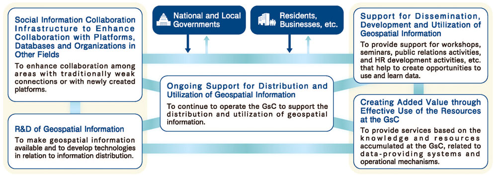
The Geospatial Information Center (GsC) is a platform that promotes the effective use and distribution of specialized Geospatial information generated and maintained by various groups for diverse purposes. It also provides logistical support to actors working to solve social issues. The center was established based on the “Basic Plan for the Advancement of Utilizing Geospatial Information” approved by Cabinet members of the Japanese government in March 2012, and has been in operation since November 24, 2016. The GsC is managed by the Association for Promotion of Infrastructure Geospatial Information Distribution (AIGID).
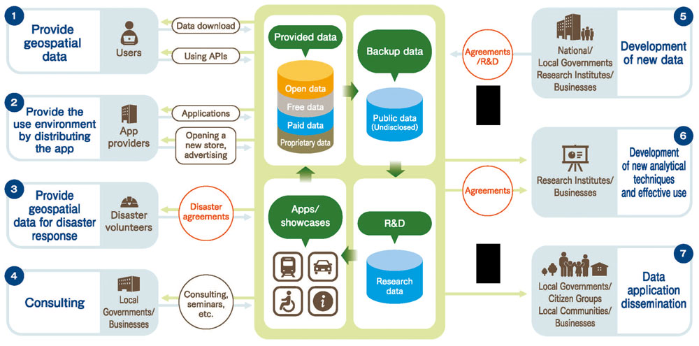
It provides a one-stop search system for geospatial data and related information which users require, whether for a sales purpose or free of charge. In general, the center is a platform that supports distribution of data that maximize the social value of geospatial information. Our activities include participating in various events, promotional activities, and organizing seminars. In addition, we deploy projects aimed at innovation creation, such as R&D and data curation.
Collaboration Across Organizations
The GsC promotes the effective use of geospatial information by integrating and combining information among public, private and academic sectors, contributing to the creation of high value for society as a whole.
Our Services
We provide one-stop access to a variety of geospatial information (G-spatial information).